Thanks to Boulder County’s now eight-plus year partnership with C4C on The North Foothills Safety for All Project, Boulder County staff had a video meeting with C4C’s board and staff to go over progress on the project. That meeting created some working positions for C4C which are described below.
The South End Design
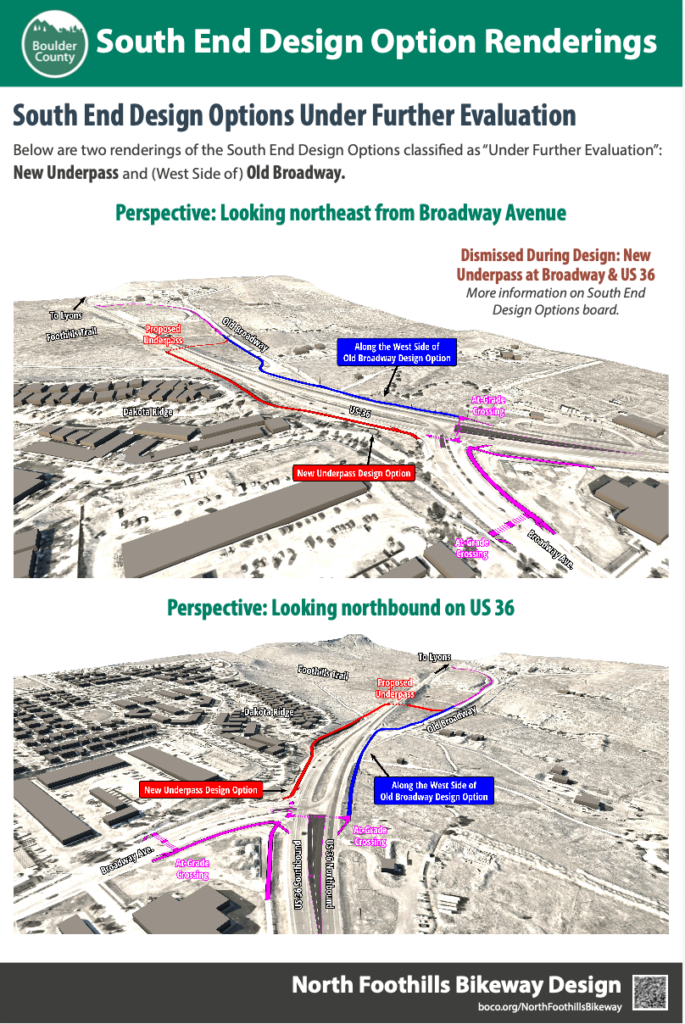
C4C favors the blue option mainly because it prevents northbound cyclists from 28th St. / US 36 South from having to perform a “vehicular” left turn in the system of highway speed auto traffic at the signalized intersection. This would be a vulnerable maneuver for cyclists. Instead, the blue option allows those cyclists to access the separated path by simply veering right.
Cyclists approaching from North Broadway would still have to cross the intersection. They would do so with the option of using the pedestrian crosswalk and/or would not have to participate in the auto-traffic or “vehicular” system while being as vulnerable.
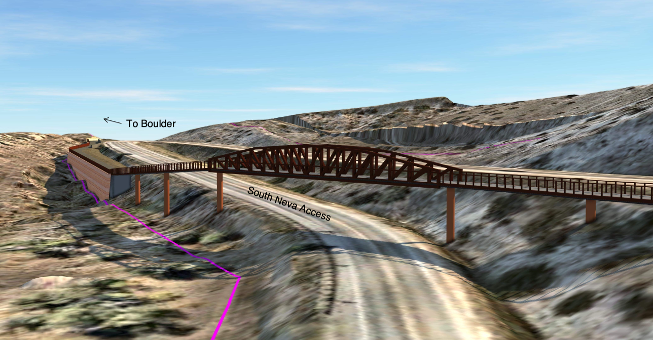
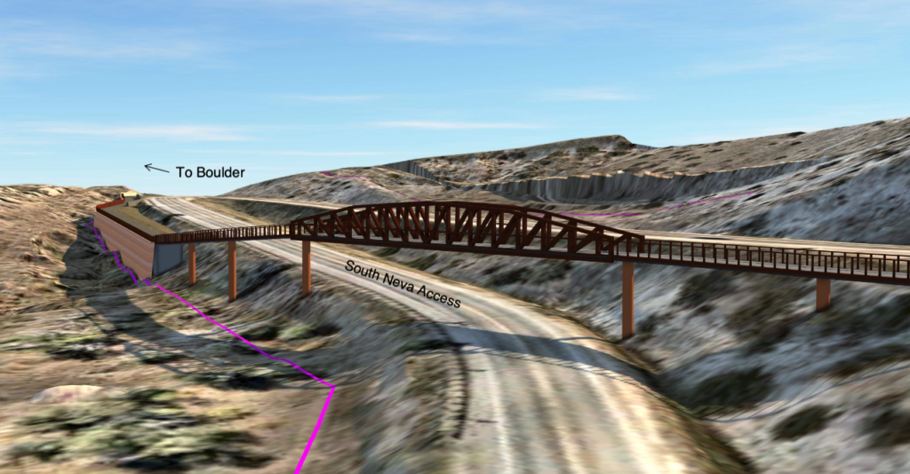
Neva Road Intersection
Not cheap, C4C far and away favored the use of an overpass as shown below. This is a great solution and it keeps both auto and bike-ped traffic separated and flowing all at once.
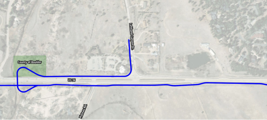
Lefthand Canyon Drive Intersection
The two current options include either an underpass at Lefthand Creek or the installation of a signal at the intersection, both shown below. C4C asked about a third option, a roundabout. When properly designed, roundabouts have good safety data, they bring down the “design-speed” of a roadway, and they keep traffic flowing.
The above option would put an underpass under the bridge over Lefthand Creek, south of the intersection.
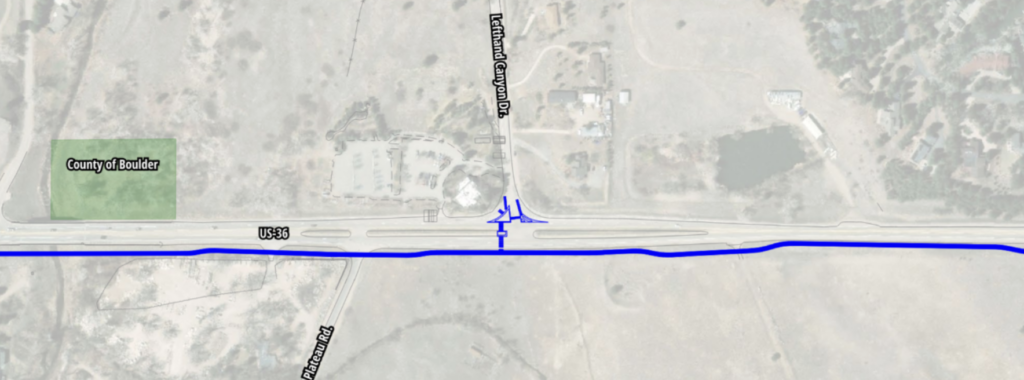
This option would put a traffic signal at the intersection and allow cyclists to cross at the pedestrian signal.
These options were a toss-up for C4C. It seems like all parties are still thinking the Lefthand intersection over.
The Highway 66 Intersection
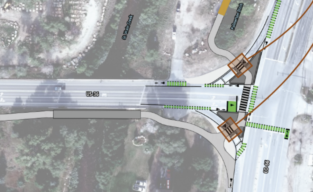
For C4C, the above looks good. Cyclists traveling north can enter the pedestrian crosswalk system to access the soft-surface trail to the west or to access the roadway in either direction in front of them at the T intersection. There are some details about getting to the path from the east or west and the county is looking at design for those including a bike-box. Construction here would also be a good time to add shoulder on the north edge traveling westbound where there’s currently no shoulder at all for a segment.
Keep in mind, according to Boulder County’s Transportation Master Plan, someday there will be a linking hard surface path along CO 66 Longmont – Lyons and a linking soft-surface St. Vrain Greenway Regional Trail from Longmont to Lyons too. Add in improvements to roadway safety and bus/transit access and, slowly but surely, things are coming together.