Thanks to Jefferson County Open Space’s methodical advancement of plans, even difficult ones like this one, the Colorado Front Range Trail is making progress. See the above flyer to link to more information.
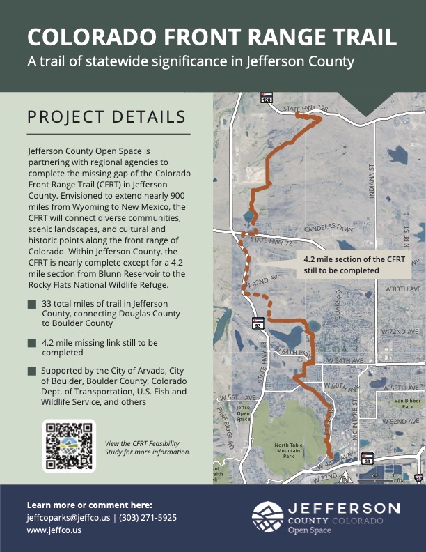
The dotted line section will probably get design funding later this year and it’s a tricky section.
That same dotted line section will likely be paved and the design may or will probably contain an underpass at the railroad and an overpass at the entrance/exit to the dump.
Thanks to The Town of Superior and Boulder County, there will be an underpass at the High Plains/Coalton Trailhead area to connect to the Dirty Bismark system connecting across Highway 128/West 120th.
C4C has asked if the hard surface section in JeffCo can be built to hard surface standards like those of the US 36 Boulder-Westminster path, the 119 Boulder – Longmont path, and the plan/design for the North Foothills Bikeway. That would make it 12′ wide, separated from the roadway, and grade separated (over/underpasses at roadways) for safety and appeal.
If so, it could form the beginning of a hard-surface separated path between Golden and Boulder along Highway 93.
JeffCo Parks and Open Space, Arvada, and Golden have all taken time to listen. C4C is also pleased to keep working with @bikejeffco on these topics.