
The South Saint Vrain is a classic Boulder County road ride. If one starts in the City of Boulder, it’s about four to four and a half hours and about 60 miles. There are plenty of add-ons if one desires.
If this ride is new for the reader, here is a very useful way to conceive of routes in Boulder County, https://assets.bouldercounty.gov/wp-content/uploads/2022/08/boulder-county-bike-map.pdf. Find Lyons in northern Boulder County and then see the South Saint Vrain Canyon departing Lyons to the southwest.
The trick is getting to the base of the South Saint Vrain Canyon which is also designated as Highway 7. The Highway 7 designation can be a little confusing. US 36 North Foothills Highway Boulder – Lyons is a high stress roadway and so is Highway 66, Longmont to Lyons. Some folks leaving from Boulder will leave early in the morning to avoid traffic. Some folks also leaving from Boulder will snake their way north on the dirt roads between Boulder and Highway 66 and east of North Foothills Highway.
Moxie Mercantile in Lyons will delight most cyclists. Squint and imagine oneself in France or Italy taking a coffee stop.
Once you’re in the South Saint Vrain Canyon, there is generally a 4′ climbing lane/bike-able shoulder on the westbound side. This is an upgrade that was done during the repair and reconstruction of the roadway after the 2013 flood. The entire canyon is scenic and the grade is steady with no truly steep sections.
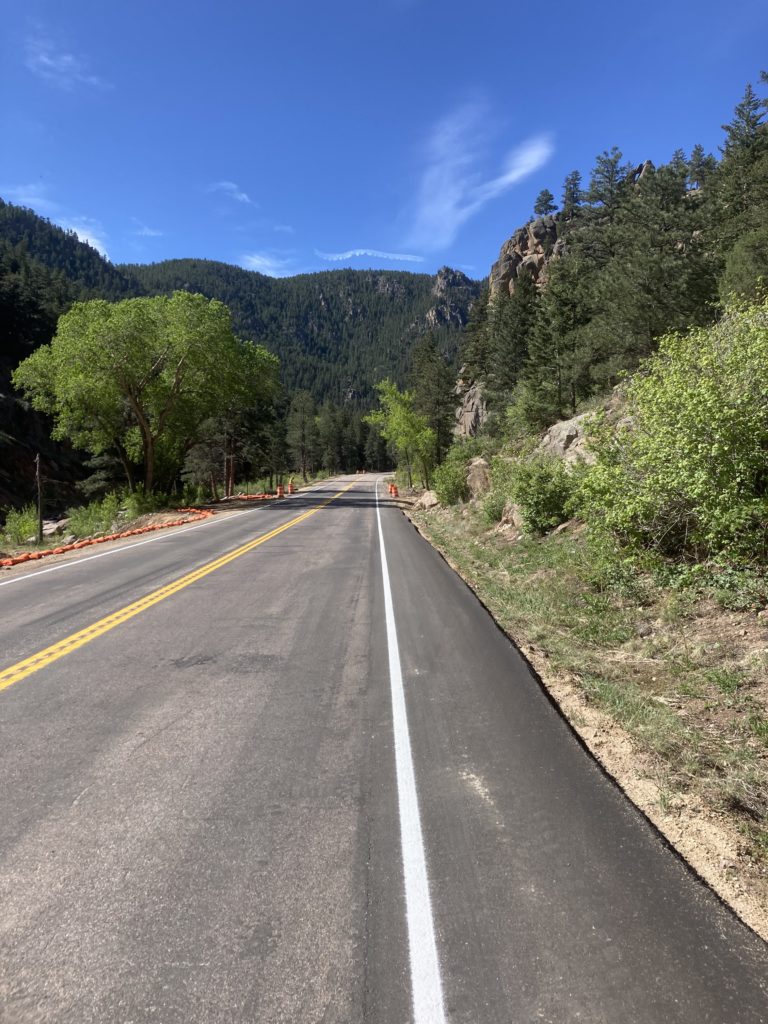
The South Saint Vrain was the last of the major repair projects following the 2013 floods. It got a 4′ uphill climbing shoulder for cyclists during that project.
For years there was a small store in Raymond. The talk was that the owner was a Marine Corp veteran. He would write your total amount due by hand on scrap paper. He was a kind man and cyclists always liked visiting with him. The store has changed hands a couple times and remains closed but there is now a pop-up store on weekends from June through August that is operated by the current owners. Say thanks to the owners who are incrementally trying to serve cyclists a little more in their second year as proprietors of The Raymond Store Cabins.

The pop-up store open on weekends June through August located in Raymond. C4C pays for a porta-potty that’s around the corner from this photo.
Most riders bear left through Raymond-Riverside to the T intersection with the Peak-to-Peak Highway where they turn left and continue to Ward. This is the part that is a haul, mostly uphill, and at the Peak-to-Peak’s average 9000′ elevation. Once at Ward, there are choices but the simple route is down Lefthand Canyon and back to the City of Boulder as preferred. There’s a store in Ward. There’s also free water at a water outlet near the bottom of Ward where its municipal water system drains. It’s potable and cold.
One of the classic Boulder County features of this ride is that after all the work to get to Ward, the turn down Lefthand Canyon takes you back to the City of Boulder in no time. It’s all downhill for something like 17 miles.
In the autumn, the Peak-to-Peak becomes cooler fast but the part of the ride through the aspens in Raymond-Riverside is beautiful. On a weekday, from Lyons onward is a fantastic road ride. One can ride it the other way, clockwise, and do all the work up Lefthand, enjoy a long but relatively slow downhill to Lyons, but that ends up putting a cyclist on crowded highways in the daytime.
A true road ride, this ride is a good example of how cycling has changed in Boulder County. Many cyclists think twice about how much time they spend on some of these roads. Otherwise, it’s a great ride.